Maps
Norway Cruise
🚢 Norwegian Fjords Cruise Map - Implementation Overview
🗺️ Project Status: Phase 2 Complete
This interactive map is designed as a comprehensive planning and reference tool for the upcoming May 2026 Norwegian Fjords cruise. It combines logistical itinerary data with real-world cruiser insights and high-quality visual aids.
🛠️ Implemented Features
1. Interactive Geospatial Interface
- Base Map: Uses Leaflet.js with a clean "CartoDB Light" theme for high legibility.
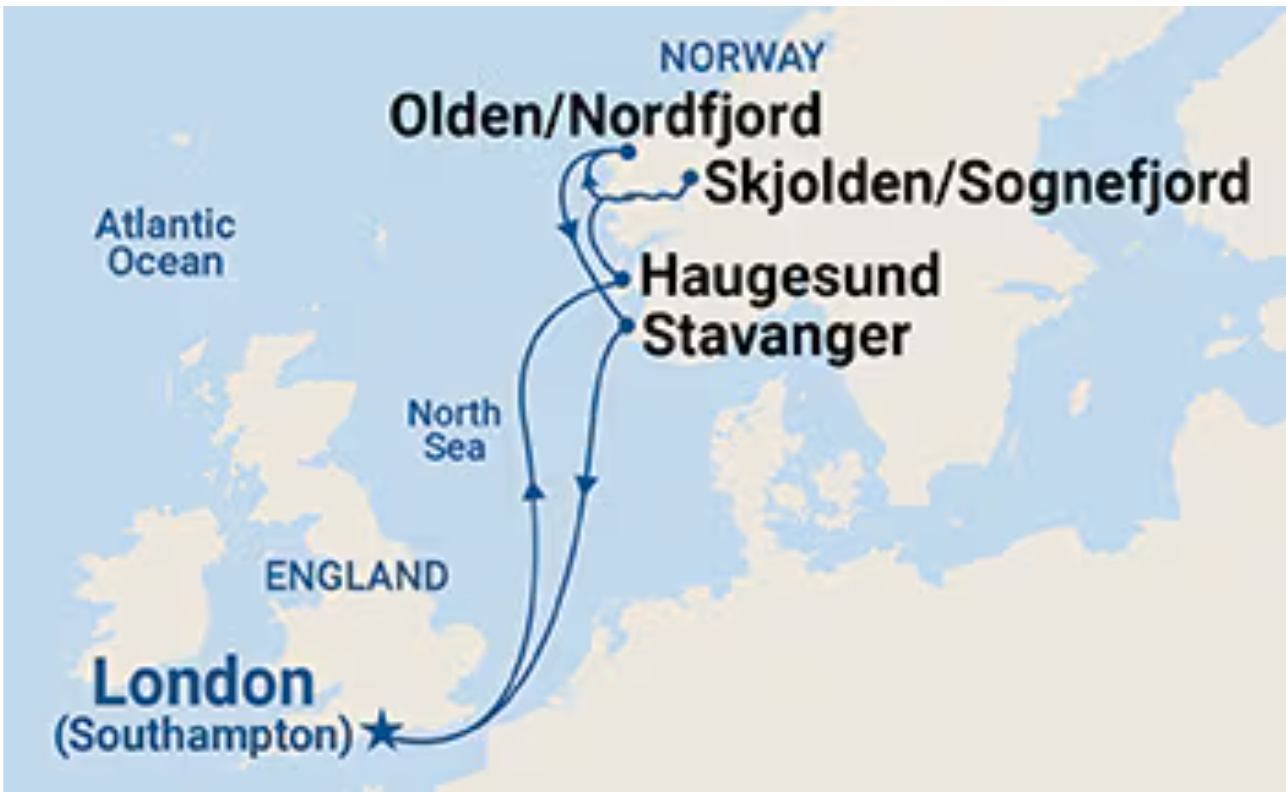
- Dynamic Routing: A dotted nautical path visualizes the journey from Southampton through the fjords and back.
- Fly-to Interaction: The side itinerary panel allows one-click navigation to any port, centering the map and opening the relevant details.
2. Rich Data Popups
- Local Imagery: High-quality, locally stored images for every port to ensure offline reliability and fast loading.
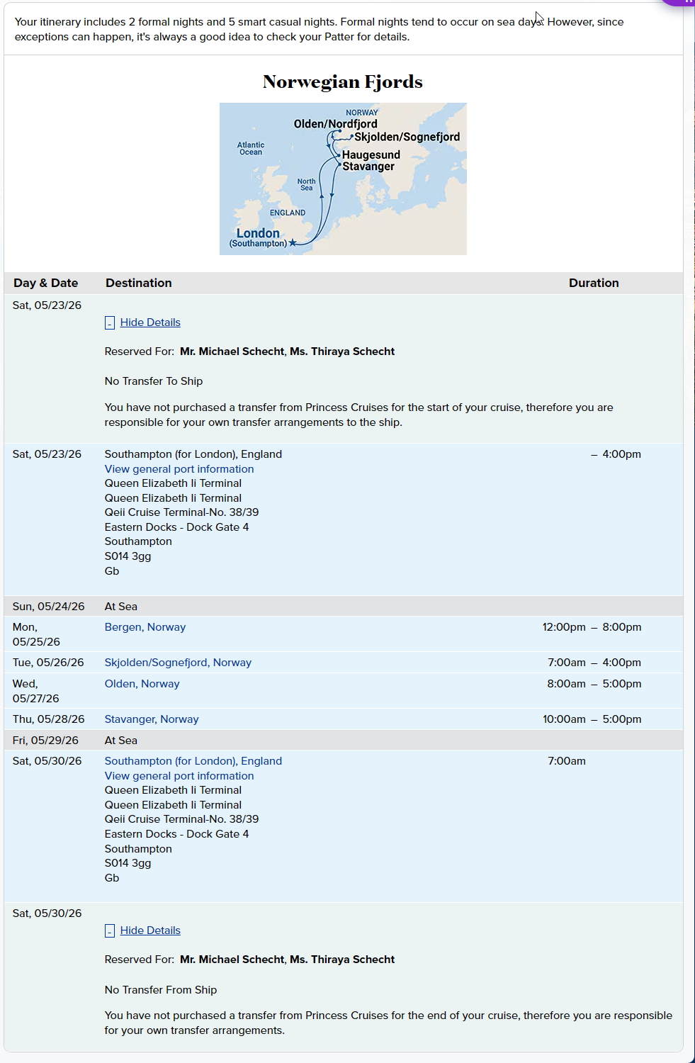
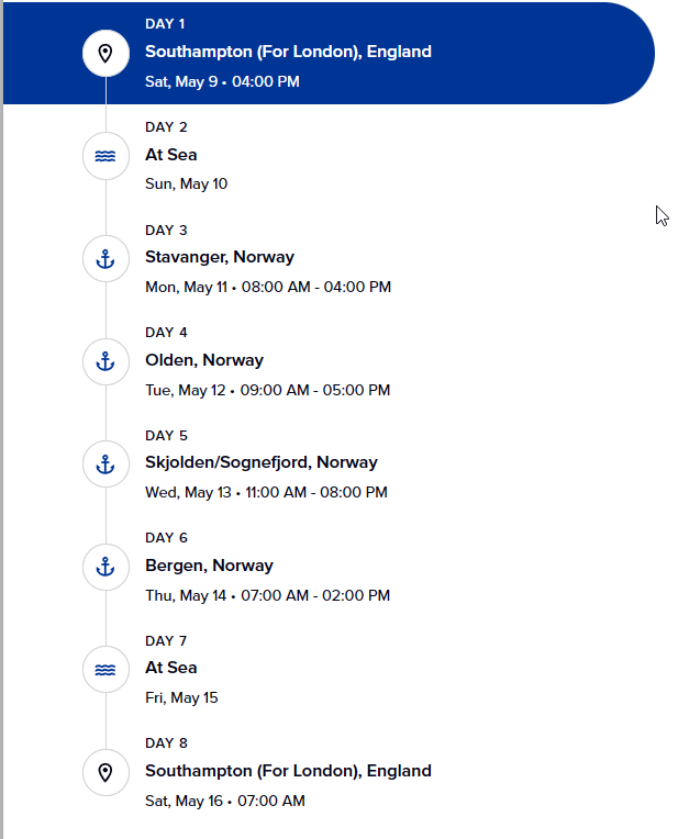
- Logistics: Includes arrival/departure times and exact dates for each stop.
- Walkability Badges: "Feet" icons with status (e.g., "Highly Walkable") to help plan shore activities.
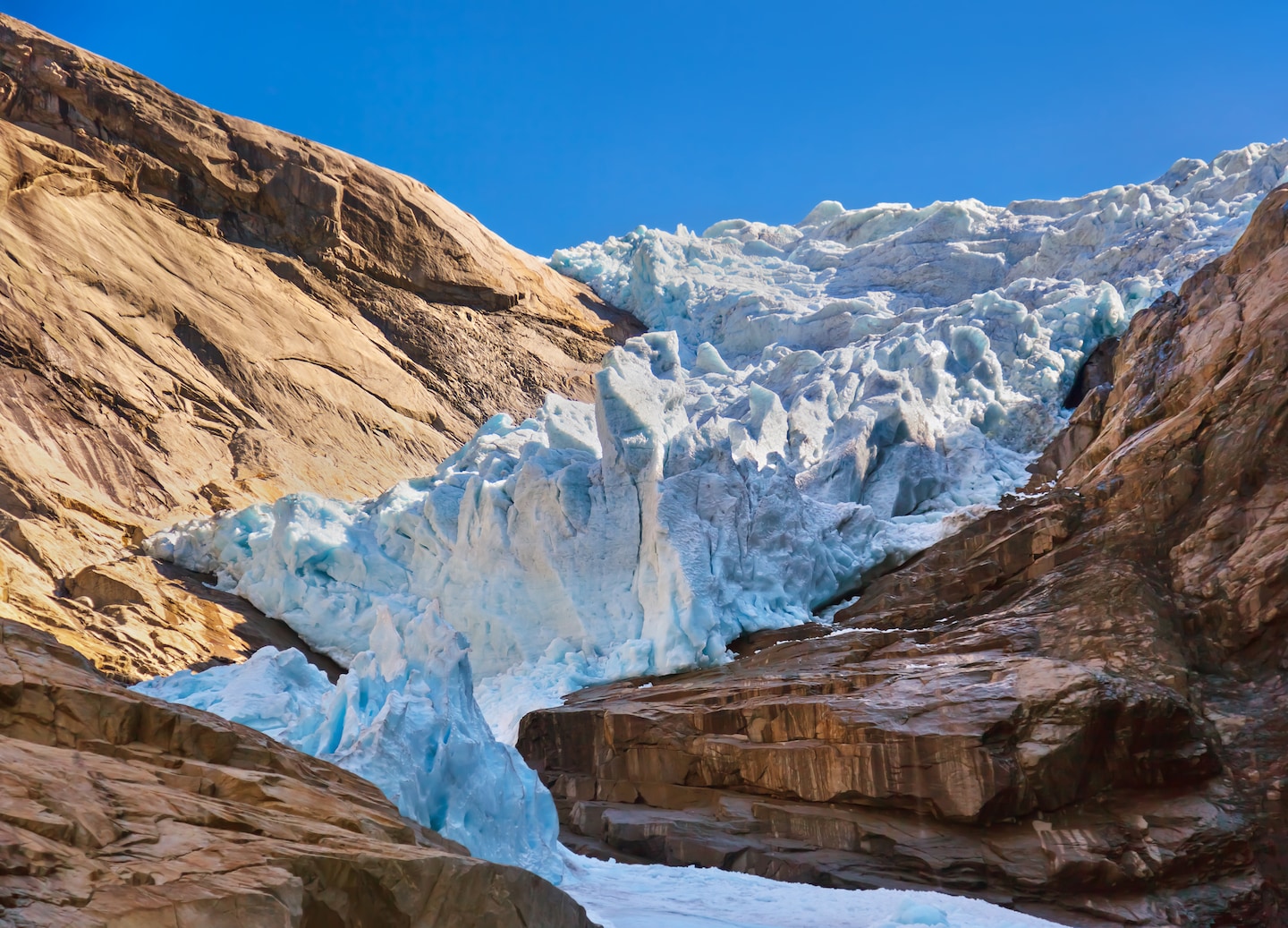
- Must-Do Activities: Hand-picked recommendations based on port highlights (e.g., Fløibanen funicular, Briksdal Glacier).
3. Cruiser Insights (The "Secret" Layer)
- Cruiser Secrets: Pro-tips sourced from travel forums (e.g., booking tickets online to skip lines, hidden gems like Fargegaten).
- Secondary Markers: Categorized points of interest for Dining (🍴) and Landmarks (📍) beyond the main port docks.
4. Environmental Context
- Weather Widget: Fixed-position guide for May climate averages (10°C - 15°C) and packing advice (layering).
- Layer Filtering: A toggle menu in the top-right to hide/show specific categories of interest.
🚀 Recommended Future Features
To take this from a planning tool to a "Live Trip Companion," consider the following upgrades:
A. Live Data Integration
- Weather API: Replace the static weather box with a live 7-day forecast for the specific GPS coordinates of each port.
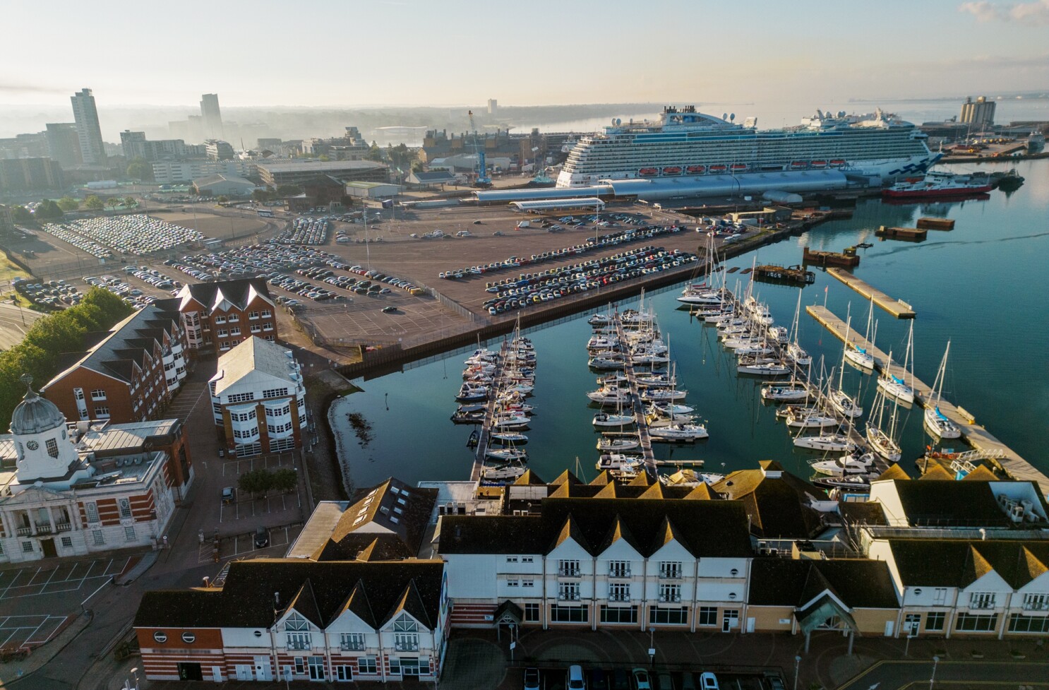
- Ship Tracker: Integrate a live AIS (Automatic Identification System) feed to show the current position of the Sky Princess on the map.
B. Personalization
- Booking Links: Hyperlink the "Must-Do" activities directly to your Princess Cruise personalizer or external booking sites.
- Note Integration: Add a feature to save personal notes or "Check-ins" for each location during the trip.
- PDF Export: A "Print View" that generates a clean, one-page summary of all port tips and logistics.
C. Advanced Multimedia
- 360° Panoramas: Link to virtual tours of the fjords for a more immersive preview.
- Soundscapes: Add a toggleable audio layer with ambient sounds (waves, Norwegian folk music, or seagulls) to set the mood.
D. Offline Mobile Support
- Progressive Web App (PWA): Convert the map into a PWA so it can be saved to your home screen and used without a stable internet connection while in the middle of a fjord.
Location: D:\AI_Agents\Repo\Mikes_Repos\AI-Automation-Library\My-Library\Maps\Norway-Cruise\norway-cruise-map.html
Last Updated: Monday, April 27, 2026
Images