Climate & Weather Events — 2005
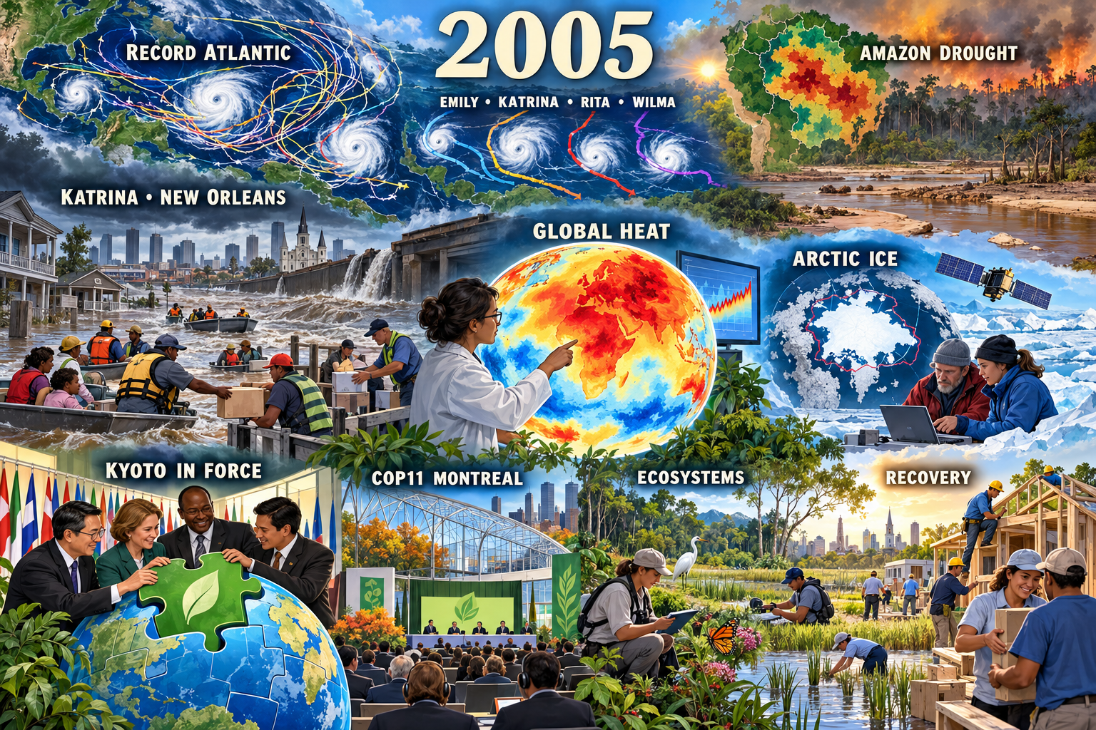
Record Atlantic hurricane season. A Gulf and Caribbean map crowded with storm tracks represents the 28-storm, 15-hurricane season described by NOAA as the most active on record.
Climate & Weather Events: 2005
- Year: 2005
- Model: built-in gpt-image
- Generation date: 2026-10-24 (UTC)
- Saved image:
My-Library/Images/Collections/Climate-Weather-Events/Images/Climate-Weather-Events_2005.png
Selected moments, reasons and sources
- Record Atlantic hurricane season. A Gulf and Caribbean map crowded with storm tracks represents the 28-storm, 15-hurricane season described by NOAA as the most active on record. Sources: https://www.nhc.noaa.gov/data/mwreview/2005.pdf and https://www.nhc.noaa.gov/archive/2005/tws/MIATWSAT_nov_final.shtml
- Hurricane Katrina and New Orleans. A breached levee, floodwater, rescue boats and supply crews make the defining U.S. disaster visible without bodies, injury, or numerical claims in the image. Source: https://www.nhc.noaa.gov/data/tcr/index.php?season=2005
- Emily, Katrina, Rita and Wilma. Four distinct schematic tracks represent the four Atlantic hurricanes that reached Category 5 intensity during the season. Source: https://www.nhc.noaa.gov/archive/2005/tws/MIATWSAT_nov_final.shtml
- Amazon drought. A rainfall-anomaly map, low river and smoky forest edge represent the widespread drought that peaked from July through September. Sources: https://science.nasa.gov/earth/earth-observatory/amazon-stands-up-to-2005-drought-8068/ and https://science.nasa.gov/earth/earth-observatory/smoke-over-the-amazon-in-2005-and-2006-8559/
- High global temperature. A scientist and anomaly globe represent NASA GISS’s contemporary conclusion that 2005 was the warmest or effectively tied for warmest year in its then-current instrumental analysis. This is not presented as its current rank. Sources: https://data.giss.nasa.gov/gistemp/news/2005/ and https://science.nasa.gov/earth/earth-observatory/global-surface-temperatures-in-2005-6228/
- Record-low Arctic sea ice at the time. Researchers, a satellite and an ice-extent map represent the September minimum then observed as the satellite-era record. Source: https://nsidc.org/ru/node/31728
- Kyoto Protocol enters into force. Generic delegates fitting a green treaty piece into a globe represent the Protocol taking legal effect on February 16. Source: https://unfccc.int/process-and-meetings/the-kyoto-protocol
- COP11 and COP/MOP1 in Montreal. A conference pavilion represents the first meeting of Kyoto Protocol parties and the completion of the treaty rule book. Source: https://unfccc.int/process/conferences/pastconferences/montreal-climate-change-conference-december-2005/statements-and-resources/COP-11-Highlights
- Millennium Ecosystem Assessment findings. Wetland, forest, pollinator and clean-water fieldwork represents the global assessment released in 2005 and its warning about degraded ecosystem services. Sources: https://www.millenniumassessment.org/en/About.html and https://www.millenniumassessment.org/documents/Document.799.aspx.pdf
- Response and recovery. Rescue boats, supply distribution, home rebuilding and wetland restoration give recovery equal visual prominence. This is a respectful synthesis of the NOAA storm sources above.
Balance and tone
Four hazard stories are balanced by temperature and cryosphere science, international policy, ecosystem assessment and rebuilding. No casualty, damage or area figures are printed or asserted in the image. Storm tracks and anomaly maps are editorial schematics, not measured reconstructions.
Readable labels
2005; RECORD ATLANTIC; EMILY; KATRINA; RITA; WILMA; KATRINA • NEW ORLEANS; AMAZON DROUGHT; GLOBAL HEAT; ARCTIC ICE; KYOTO IN FORCE; COP11 MONTREAL; ECOSYSTEMS; RECOVERY.
Final prompt used
Use case: illustration-story. Create a respectful environmental-editorial retrospective for 2005, matching Climate & Weather Events 2002, 2003 and 2004: polished cartoon-editorial science-magazine illustration, clean confident dark linework, soft cel shading, rich painterly digital detail, expressive generic responders and scientists, and geography woven into maps and landscape. One unified continuous landscape flowing from severe weather on the left through climate science and policy to conservation and recovery on the right, not panels or stickers. Large readable ivory year heading “2005” at top center. Nine integrated moments: the record Atlantic hurricane season shown by a Gulf and Caribbean weather map crowded with spiral tracks labeled “RECORD ATLANTIC”; Hurricane Katrina shown respectfully through a New Orleans waterline, breached levee, rescue boats and calm supply crews labeled “KATRINA • NEW ORLEANS”, no bodies; four major storms represented by distinct map tracks labeled together “EMILY • KATRINA • RITA • WILMA”; the severe Amazon drought shown through a rainfall-anomaly map, low river and smoky forest edge labeled “AMAZON DROUGHT”; NASA GISS’s contemporary finding that 2005 was warmest or tied warmest in its then-current record shown by a scientist and anomaly globe labeled “GLOBAL HEAT”; the then-record-low September Arctic sea ice shown with researchers, satellite and shrinking ice map labeled “ARCTIC ICE”; the Kyoto Protocol entering into force on February 16 shown by generic delegates fitting a green treaty piece into a globe labeled “KYOTO IN FORCE”; COP11 and the first Kyoto Parties meeting in Montreal shown as an open conference pavilion labeled “COP11 MONTREAL”; the Millennium Ecosystem Assessment’s 2005 findings shown by ecologists mapping wetlands, forests, pollinators and clean water labeled “ECOSYSTEMS”; and community recovery shown with volunteers rebuilding homes, restoring wetlands and distributing supplies labeled “RECOVERY”. Make Katrina and the record hurricane map, global heat and Kyoto implementation the largest anchors; balance hazards with science, policy, ecosystem research and rebuilding. Storm slate blue, hurricane white, floodwater brown and smoke amber balanced by treaty green, Arctic cyan, clear-sky blue and recovery gold. Dramatic weather at left resolves into hopeful clear light at right. Short high-contrast labels only, all spelled exactly; no casualty or damage numbers. STRICT: no gore, bodies, injured people, panic, screaming crowds, disaster-movie spectacle, exact logos, agency seals, national emblems, photorealistic real-person likenesses, fake paragraphs, tiny unreadable labels, watermarks, signatures or borders. Faces must remain visibly illustrated and generic.
QA
Viewed against 2002, 2003 and 2004. Passed: readable year and every requested label; prominent Atlantic/Katrina, global-heat and Kyoto anchors; balanced climate science, policy, ecosystem research and recovery; calm generic responders; no gore, injury, panic, recognizable real-person likeness, logo, agency seal, watermark or border. Saved natively at 1536x1024; no transcript recovery or Gemini fallback used.
More from Image Collections