Lost Cities of Antiquity — Petra
Petra was the Nabataeans' rock-cut caravan capital and flourished as a meeting point between Arabian, Hellenistic, and wider Mediterranean traditions.
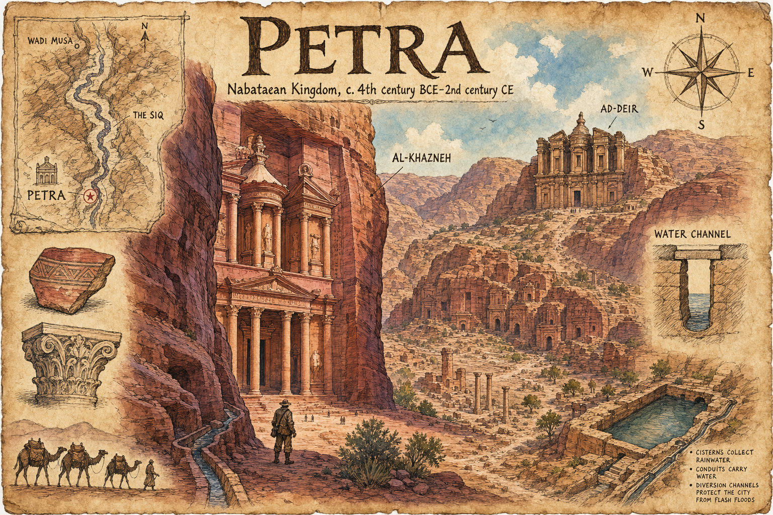
Lost Cities: Petra
- Entry slug: Petra
- Lost city: Petra
- Civilization / era: Nabataean Kingdom, c. 4th century BCE–2nd century CE
- Modern-day setting: Ma'an Governorate, Jordan
- Presentation: Rediscovered ruins. The Siq's framed reveal and surviving rock-cut facades make Petra immediately recognizable while retaining the atmosphere of an expedition journal.
- Generation date: 2026-07-25
- Model: built-in gpt-image
- Saved image:
My-Library/Images/Collections/Lost-Cities/Images/Lost-Cities_Petra.png
History and rediscovery
Petra was the Nabataeans' rock-cut caravan capital and flourished as a meeting point between Arabian, Hellenistic, and wider Mediterranean traditions. Its extensive tombs, temples, routes, and water systems testify to a city that prospered in an arid mountain basin. Local communities always knew the site; Johann Ludwig Burckhardt's 1812 visit brought it back to broad European attention.
Selected visual details
- The narrow, winding Siq frames the first dramatic glimpse of Al-Khazneh.
- Al-Khazneh's columned, pedimented, two-level rock-cut facade anchors the page.
- Ad-Deir and the Royal Tombs show Petra's monumental fusion of Hellenistic and Eastern forms.
- Rose, ochre, and violet sandstone strata establish the site's distinctive canyon geology.
- Channels, cisterns, a reservoir, and diversion works represent Nabataean water harvesting and flash-flood control.
- A Wadi Musa map, compass rose, pottery, capital, and caravan sketches reinforce the field-journal format and caravan setting.
These elements were chosen because they distinguish Petra from generic ancient ruins and jointly show architecture, geography, trade, and engineering.
Sources
- UNESCO World Heritage Centre, Petra: https://whc.unesco.org/en/list/326/
- UNESCO, preserving Petra's Nabataean architectural heritage: https://www.unesco.org/en/articles/preserving-petras-nabatean-architectural-heritage
- UNESCO, Siq and cultural landscape: https://www.unesco.org/en/articles/culture-source-sustainable-development-and-social-cohesion
- American Museum of Natural History, walk through Petra: https://www.amnh.org/explore/ology/archaeology/a-walk-through-the-ruins-of-petra
- American Society of Civil Engineers, Petra water system: https://www.asce.org/about-civil-engineering/history-and-heritage/historic-landmarks/petra/
- Nabataea.net, rediscovery overview: https://nabataea.net/explore/history/discover/
Final prompt used
Create a polished 3:2 cartoon-editorial archaeological sketchbook page of Petra as atmospheric rediscovered ruins. On aged parchment, show a central ink-and-watercolor view from the rose-red Siq revealing Al-Khazneh, with Royal Tombs and Ad-Deir across Petra's desert basin. Faithfully include the Treasury's Hellenistic-influenced facade, Siq water channels, tomb facades, cisterns, conduits, diversion works, caravan traces, and temple remains. Add a Wadi Musa/Siq map corner, compass rose, pottery shard, column capital, water-channel study, and camel caravan. Clearly letter PETRA and Nabataean Kingdom, c. 4th century BCE–2nd century CE, with short labels only. Use parchment cream, sepia ink, rose sandstone, violet shadow, and warm expedition light. Avoid modern objects, real-person likenesses, generic ruins, panels, fake paragraphs, illegible text, and watermarks.
More from Image Collections